While current navigation apps have gone a long way to become reliable and easy to use, they are still not doing one thing - help to wander and explore. Apps like Google Maps are great when you know where you’re going, however, they aren’t much use if you don’t.
Having changed my hometown almost every 2 years in the past decade, I could not find an easy way to explore and get to know a new city, without doing prior research and planning. I needed an app that could take me on a tour and show the best that the city has to offer. With that in mind, I started exploring ways to improve Google Maps.
Given the time constraints of this exercise, I focused exclusively on my personal experience. Fortunately, for the past 6 months, I hosted different friends almost every month. As a result, I have perfected my intro to SF tour, which takes around 4 hours and leaves the guests impressed by the city.
We usually start somewhere around Union Square, then go down the Market Street to Embarcadero, walk along the bay for a little bit, climb up to the Coit Tower, and walk down via the North Beach through the China Town back to the Union Square.
My local experience allows to package the beauty and diversity of the city in a relatively short walk. Something that is not possible for a tourist, or a first time visitor without prior knowledge of the place. Which brings us to the main challenge —
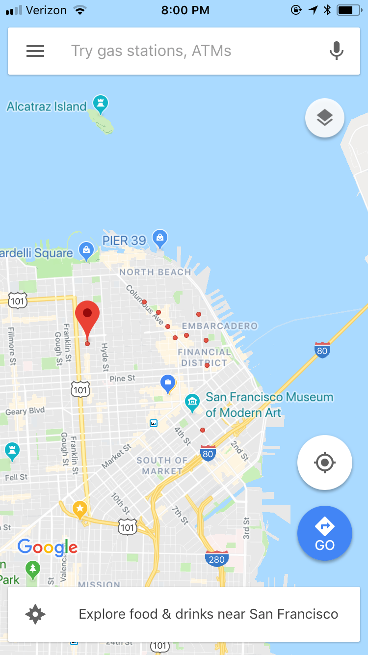
With ample of data about cities Google is gradually integrating an additional qualitative layer of information into their maps with features like Areas of Interest →
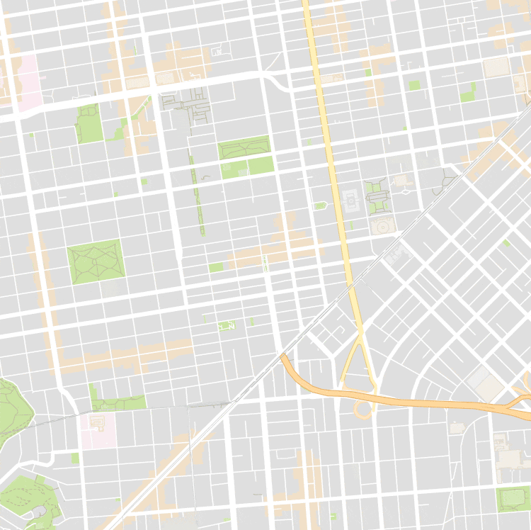
Areas of interest highlighted in the map of San Francisco.
Areas of Interest, as well as cultural, natural sights and food listings, can be used as variables to generate an infinite number of trips in cities around the world.
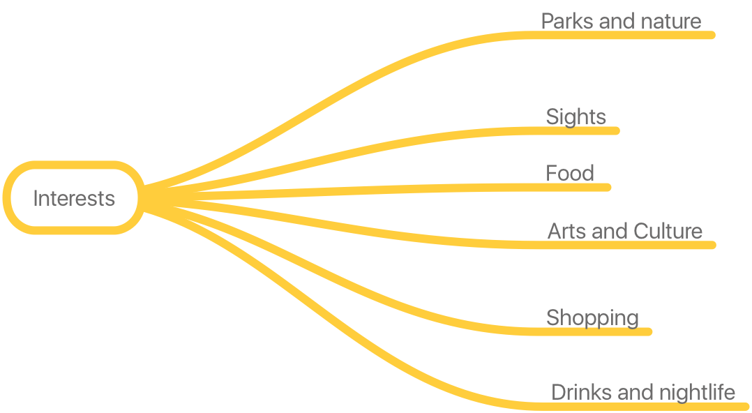
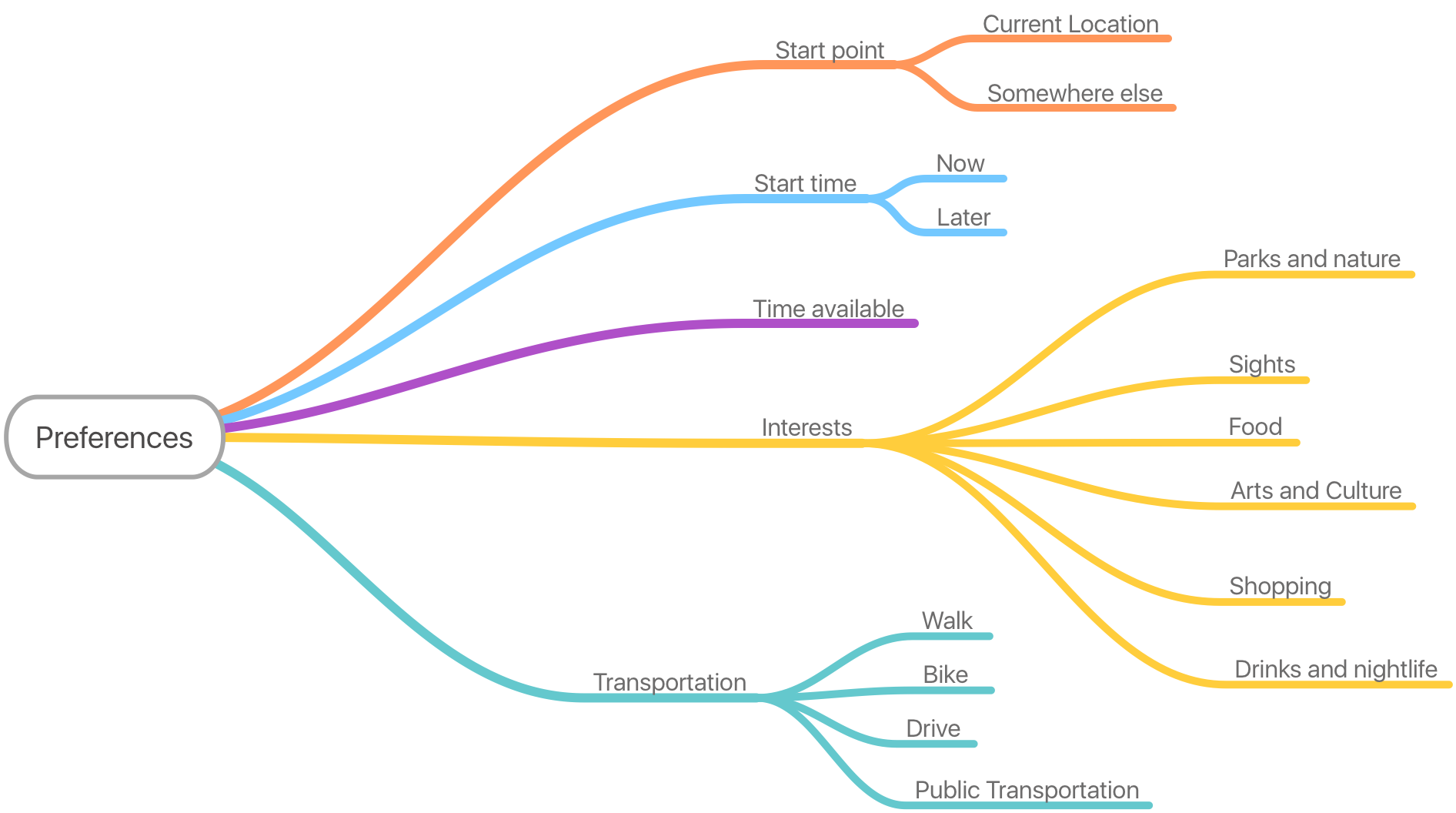
In addition to interest based parameters, functional variables such as total time available for the trip or start location would need to be provided by the user:

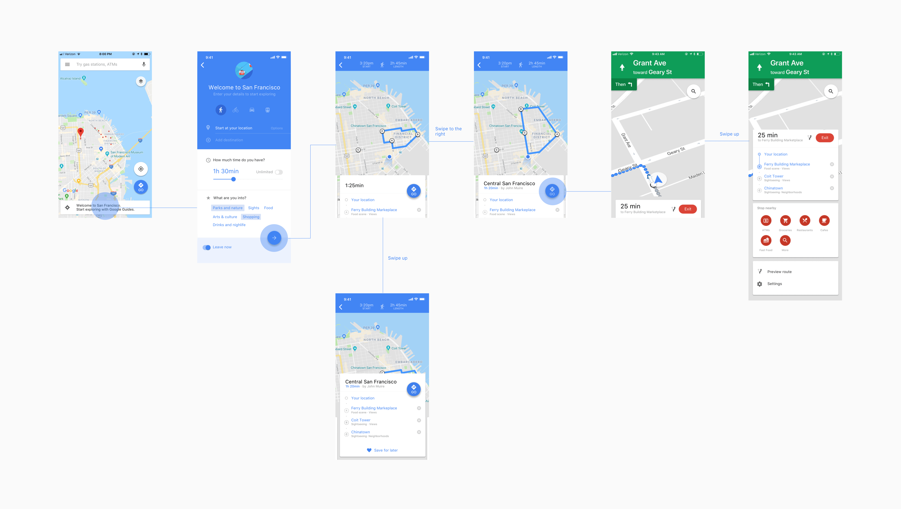
Assuming the user is brand new to the city, our feature should not require prior knowledge of geography, sights or neighborhoods. It should be straightforward to set up and use. The full end-to-end journey could be split into 3 stages: Setup → Pick a trip → Enroute.

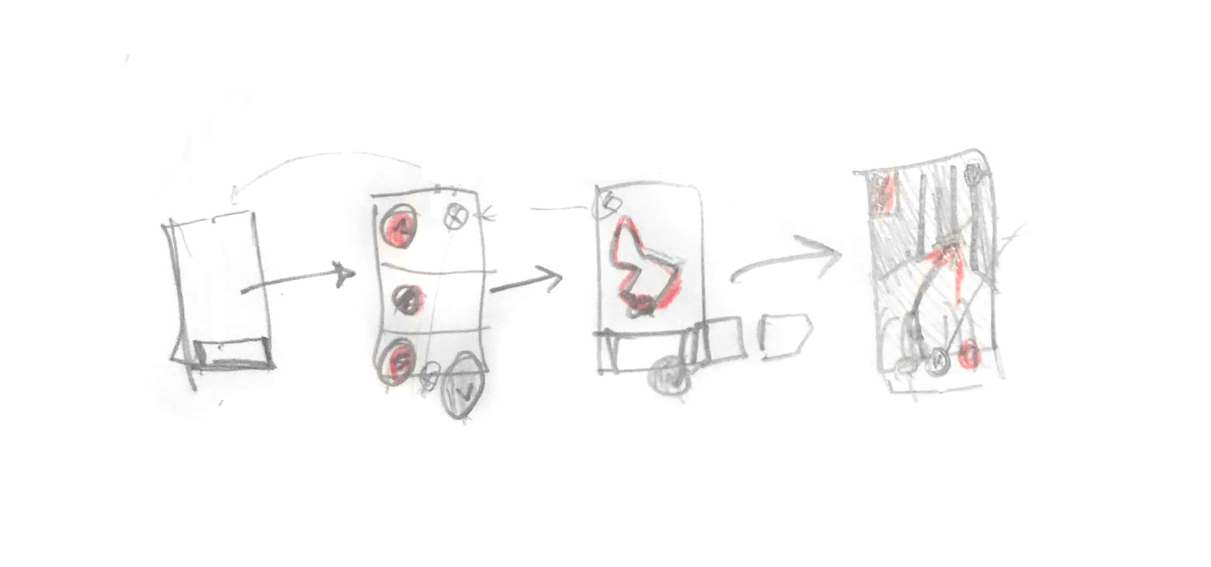
With a preliminary user flow in place, I started sketching out low-level wireframes of each step.

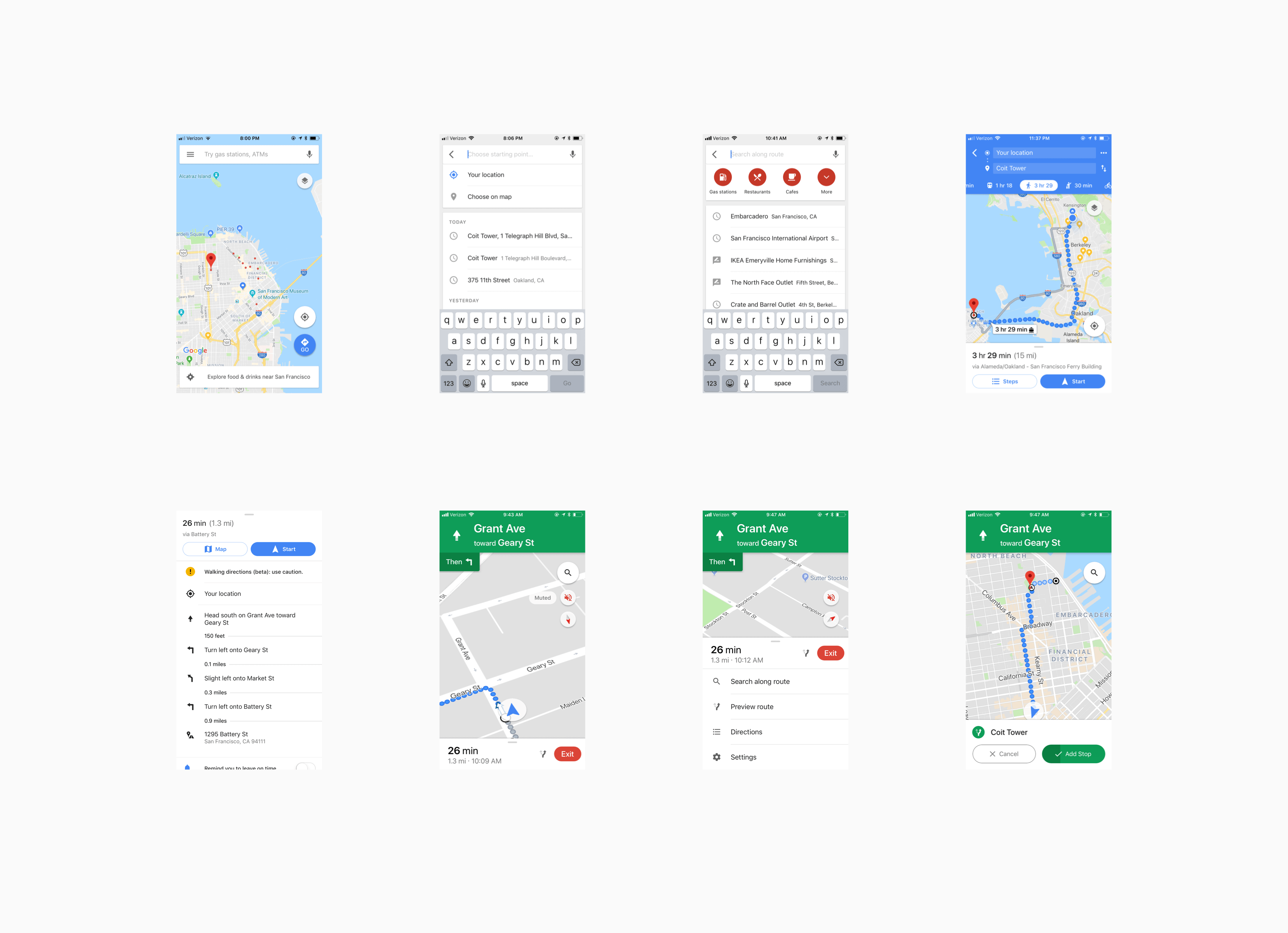
Along with that, I started looking into Google Maps' existing UI to see what elements and patterns could be reused, and what would need to be built from scratch.

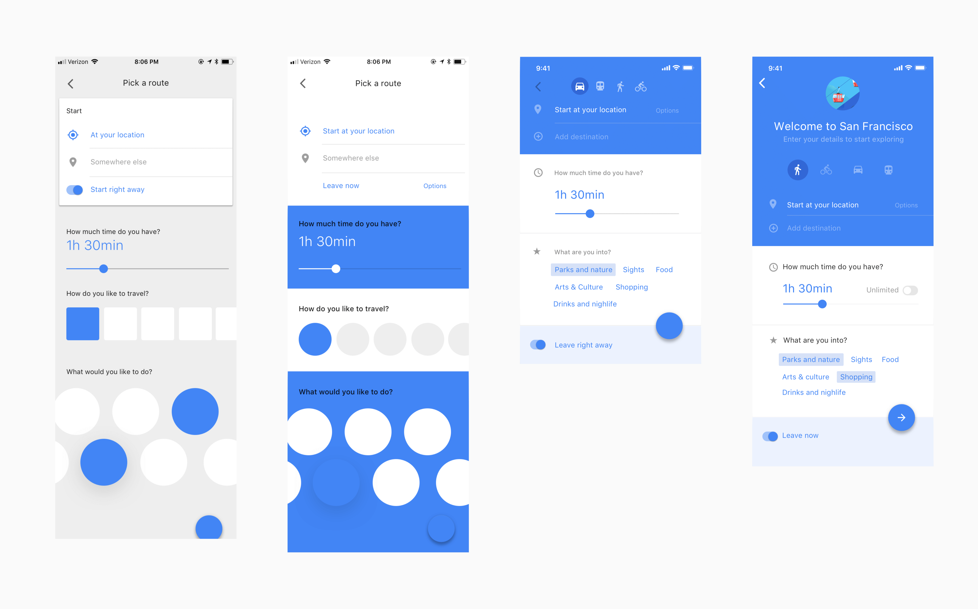
With initial parameters in place, I could start iterating on the UI of the Setup screen. The default state of the UI is optimized for the first time visitors, requiring minimum effort or prior knowledge about the city. However, it can be easily expanded by adding additional variables, such as granular interest tags (e.g. broad category of Arts & culture could be split into Museums, Galleries, Neighborhoods and etc.) giving the user more control over the outcome.

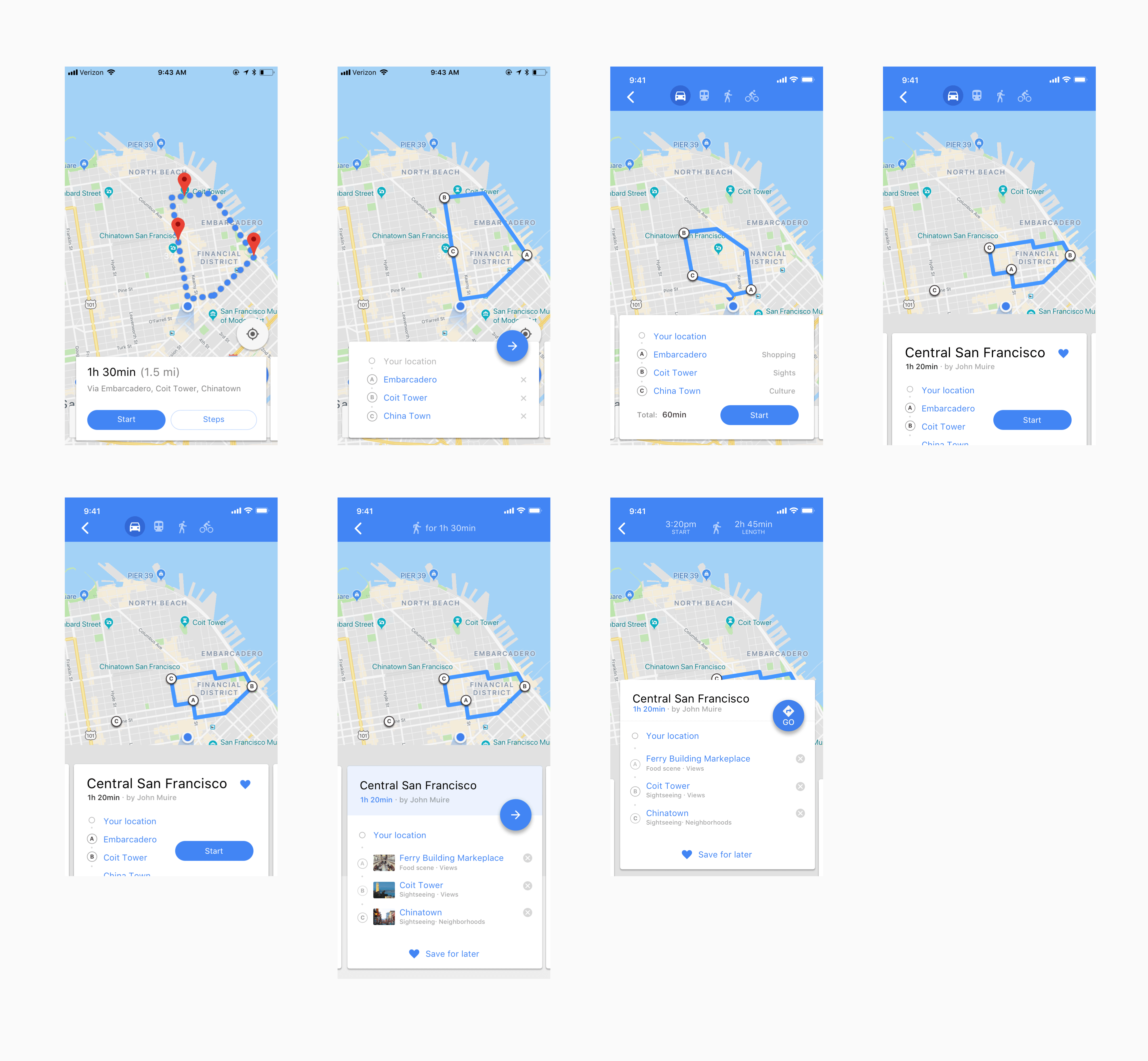
The goal of the Routes screen is to get the user to pick one of the routes, generated based on their preferences. In a series of design iterations, I tried to establish a range of options, varying from a minimal overview of the route, to an explicit list of sights and their respective categories. Having a diverse range of options allows to identify the optimal ballance of information and its hierarchy through qualitative user research or a/b testing.

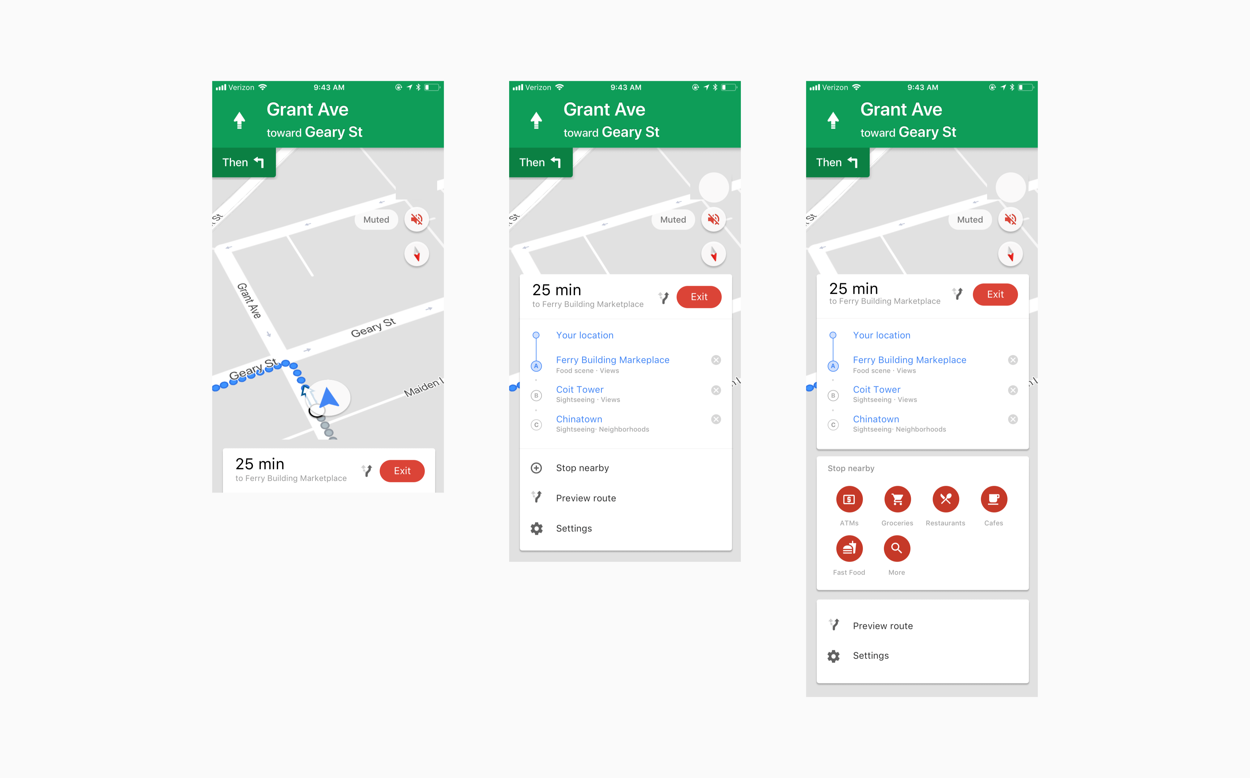
The biggest challenge when designing the navigation screen was to present the actions and trip information without detracting user's attention from the main goal — navigating the streets. Drawing on the existing UI of Google Maps and consistent with the rest of the flow, I incorporated route overview and quick actions as a series of cards, swipe-able from the bottom of the screen.

The user flow bellow lays out the main touch points of the feature and could be used as a basis for prototyping and user validation. In addition, it opens up a series of interesting considerations for the next iterations:
1. How could the app facilitate user's experience when they reach the destinations on their route?
2. Should the trips be algorithmically generated or crowdsourced from the users?
3. Will such feature increase the utility value of Google Maps or dilute it, and should be a standalone product?
4. What are opportunities for monetization (restaurant / ticket booking) and how could they be integrated into the flow?

Up
While current navigation apps have gone a long way to become reliable and easy to use, they are still not doing one thing - help to wander and explore. Apps like Google Maps are great when you know where you’re going, however, they aren’t much use if you don’t.
Having changed my hometown almost every 2 years in the past decade, I could not find an easy way to explore and get to know a new city, without doing prior research and planning. I needed an app that could take me on a tour and show the best that the city has to offer. With that in mind, I started exploring ways to improve Google Maps.
Given the time constraints of this exercise, I focused exclusively on my personal experience. The good news is that living in San Francisco people just want to visit you. For the past 6 months, I hosted friends almost every month. As a result, I have perfected my intro to SF tour, that takes around 4 hours and leaves the guests impressed by the city.
We usually start somewhere around Union Square, then go down the Market Street to Embarcadero, walk along the bay for a little bit, climb up to the Coit Tower, and walk down via the North Beach through the China Town back to the Union Square.
My local experience allows to package the beauty and diversity of the city in a relatively short walk. Something that is not possible for a tourist or a first time visitor. Which brings us to the main challenge —
With ample of data about cities Google is gradually integrating an additional qualitative layer of information into their maps with features like Areas of Interest →


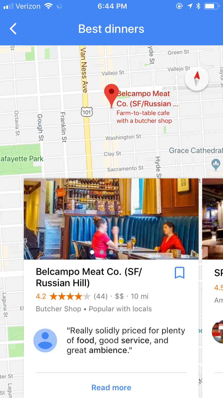
Or the recently introduced Restaurants integration.
Areas of Interest, as well as cultural, natural sights and food listings, can be used as variables to generate an infinite number of trips in cities around the world.
In addition to interest based parameters, functional variables such as total time available for the trip or start location would need to be provided by the user:

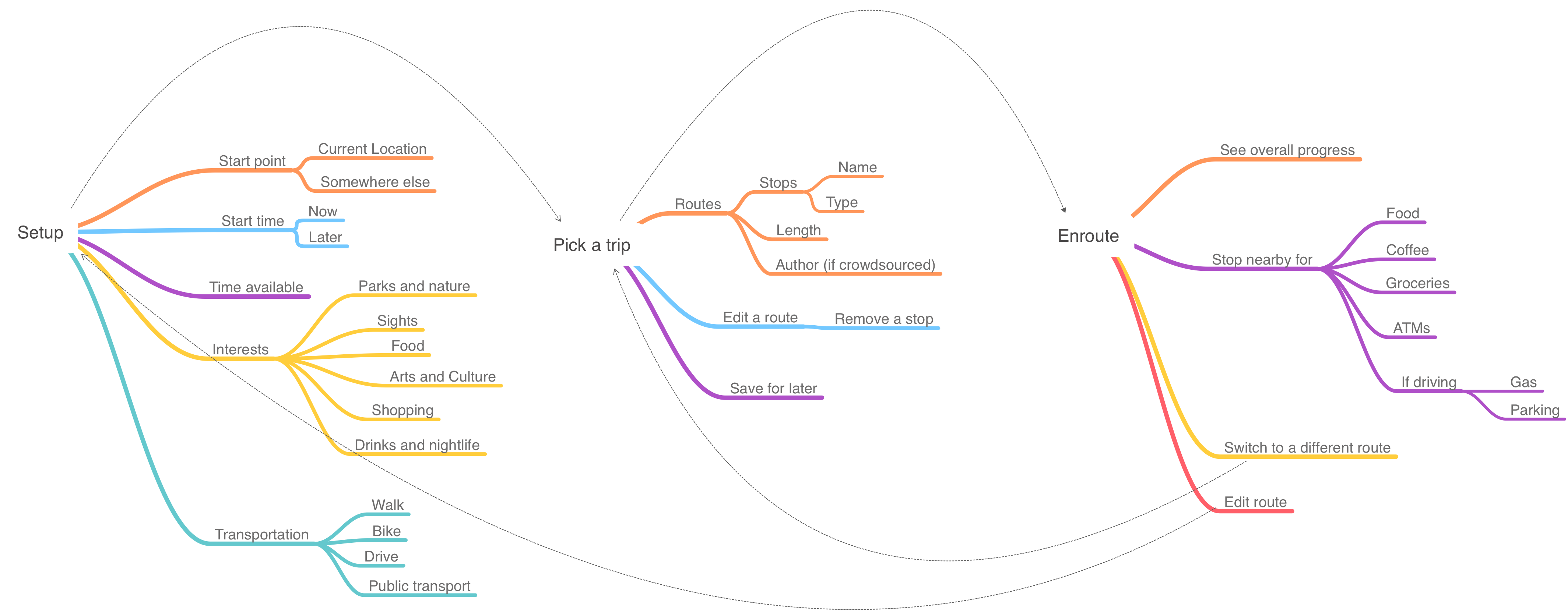
Assuming the user is brand new to the city, our feature should not require prior knowledge of geography, sights or neighborhoods. It should be straightforward to set up and use. The full end-to-end journey could be split into 3 stages: Setup → Pick a trip → Enroute.

With a preliminary user flow in place, I started sketching out low-level wireframes of each step.

Along with that, I started looking into Google Maps' existing UI to see what elements and patterns could be reused, and what would need to be built from scratch.

With initial parameters in place, I could start iterating on the UI of the Setup screen. The default state of the UI is optimized for the first time visitors, requiring minimum effort or prior knowledge about the city. However, it can be easily expanded by adding additional variables, such as granular interest tags (e.g. broad category of Arts & culture could be split into Museums, Galleries, Neighborhoods and etc.) giving the user more control over the outcome.

The goal of the Routes screen is to get the user to pick one of the routes, generated based on their preferences. In a series of design iterations, I tried to establish a range of options, varying from a minimal overview of the route, to an explicit list of sights and their respective categories. Having a diverse range of options allows to identify the optimal ballance of information and its hierarchy through qualitative user research or a/b testing.

The biggest challenge when designing the navigation screen was to present the actions and trip information without detracting user's attention from the main goal — navigating the streets. Drawing on the existing UI of Google Maps and consistent with the rest of the flow, I incorporated route overview and quick actions as a series of cards, swipe-able from the bottom of the screen.

The user flow bellow lays out the main touch points of the feature and could be used as a basis for prototyping and user validation. In addition, it opens up a series of interesting considerations for the next iterations:
1. How could the app facilitate user's experience when they reach the destinations on their route?
2. Should the trips be algorithmically generated or crowdsourced from the users?
3. Will such feature increase the utility value of Google Maps or dilute it, and should be a standalone product?
4. What are opportunities for monetization (restaurant / ticket booking) and how could they be integrated into the flow?
Up